NH Seacoast Greenway in Portsmouth
The New Hamphire Seacoast Greenway (NHSG) is a proposed bicycle and pedestrian route that will connect the eight coastal communities of Seabrook, Hampton Falls, Hampton, North Hampton, Rye, Greenland, New Castle and Portsmouth. The route will total 17.2 miles, and it is anticipated that virtually all of it will use the abandoned corridor of the former Boston and Maine Railroad from Seabrook to Portsmouth. At each end, the NHSG will connect with existing or planned trails: Maine’s Eastern Trail runs from Kittery to South Portland, while the Border-to-Boston Trail in Massachusetts is being developed in segments that will ultimately link Salisbury to Boston. In a much larger context, the NHSG is a link in the East Coast Greenway, a nearly 3,000-mile network of connected trails from Calais, Maine to Key West, Florida.
Ownership
The State of New Hampshire, under the jurisdiction of the NH Department of Transportation, now owns the entire former "Hampton Branch" abandoned rail corridor from the Massachusetts state line to Portsmouth. The portion of the NHSG that is located on this former rail corridor will be designed, constructed, and managed as a partnership between the local communities and NHDOT. In Portsmouth, there is also a portion of the NHSG that will follow local roads, which are owned and managed by the City.
The NH Seacoast Greenway in Portsmouth
In Portsmouth, the NHSG route follows the 3.6 miles of the former abandoned rail corridor between Barberry Lane and the Greenland town line. There is presently no off-road route connecting from the Barberry Lane terminus of the former rail corridor north, but the City is working on providing safe and comfortable on-road and off-road connections for bicyclists and pedestrians to get from the northern rail trail terminus to Portsmouth's West End and Downtown (and ultimately to Maine).
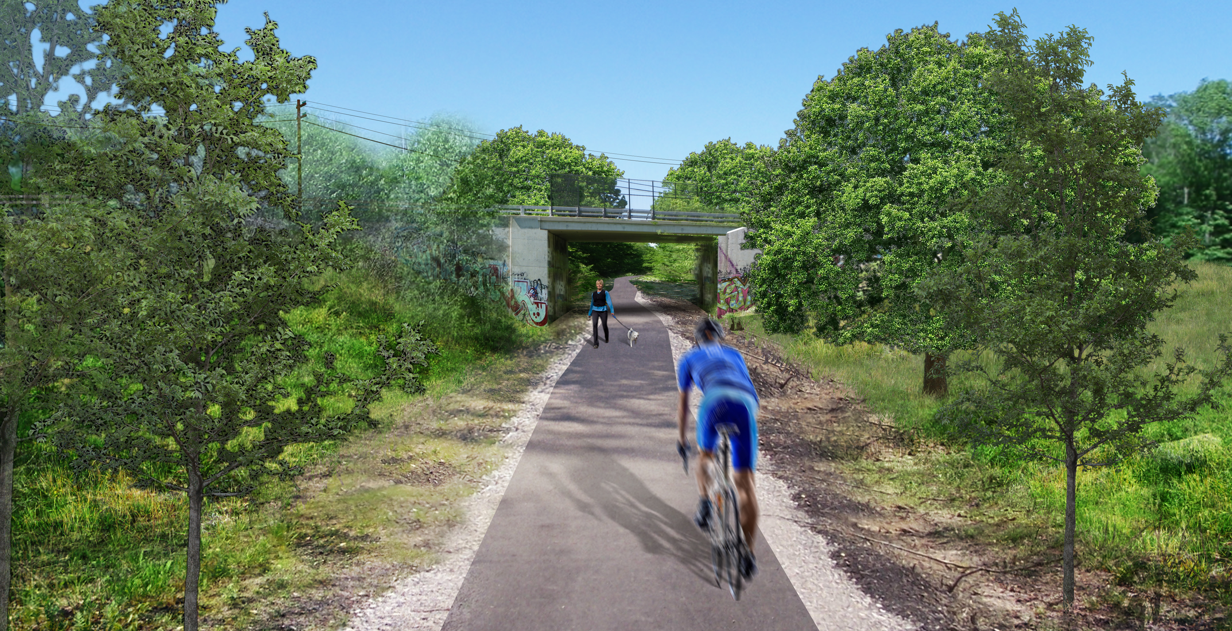
The Rail Trail in Portsmouth
NHDOT has received federal funding for acquisition and initial design of the rail trail from Hampton to Portsmouth. Now that the rail corridor has been acquired, the state is working with local communities to start the design, permitting, and construction of the trail. In addition to the federal funding, the City has included local funding in the Capital Improvement Plan since 2013 to enhance the Portsmouth portion of the rail trail as well as for the creation of access points.
In Portsmouth, access points are currently planned as follows (click on the map to the right to view these locations):
- Barberry Lane (#1 on the Map)
- between Borthwick Avenue and Islington Street (#2 on the Map)
- at the former City "stump dump" and across from the NHDOT Park & Ride off of Route 33 (#3)
- at Banfield Road (#4)
- at Ocean Road (#5)